
Loving Life Having Fun

Colorado Adventures – Loving Life Having Fun

Colorado landscape
Colorado

Colorado Adventures – Loving Life Having Fun

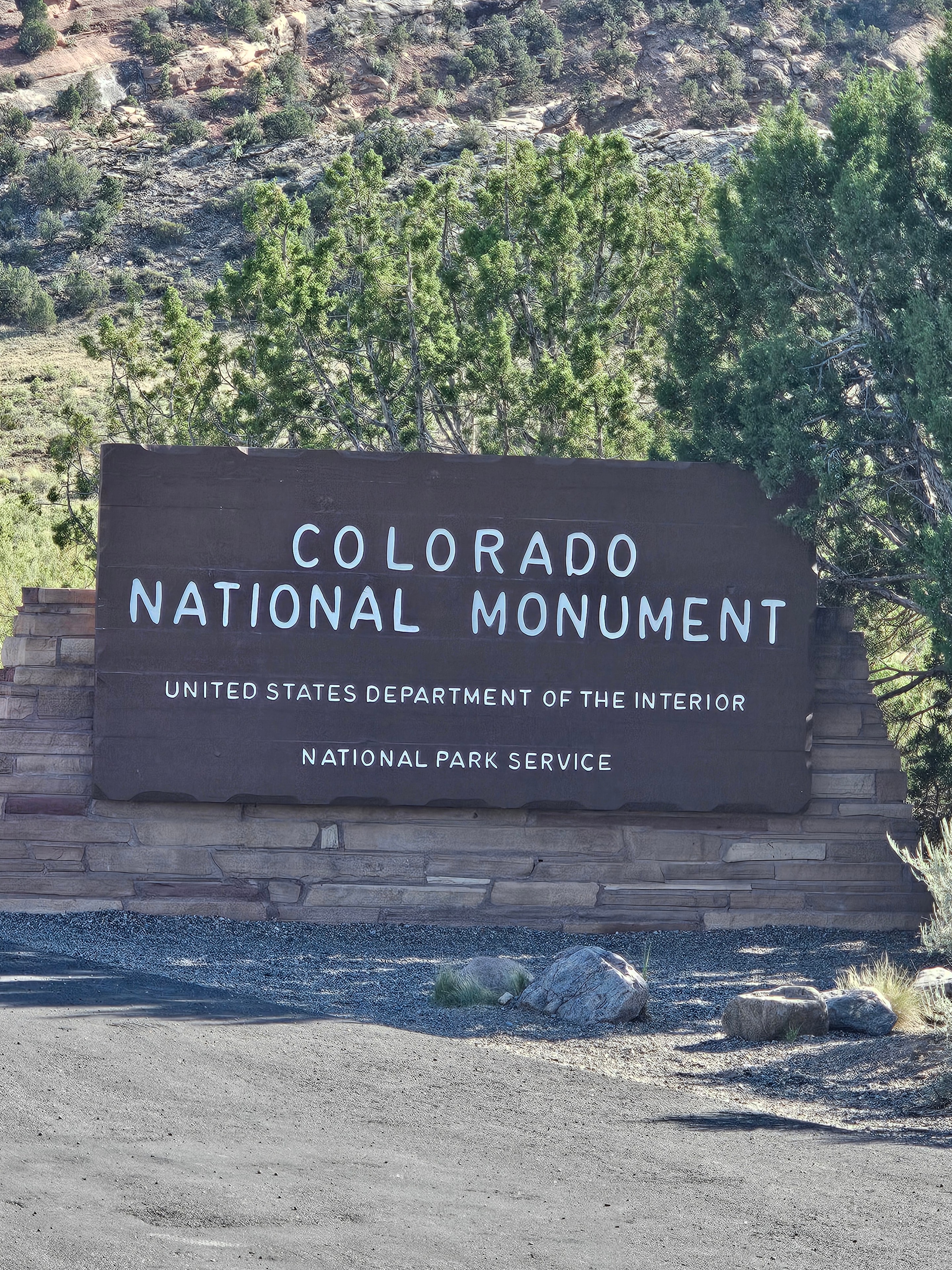
Colorado National Monument, Fruita, Colorado

Colorado National Monument sits above the Grand Valley just outside Fruita, Colorado, and it is one of those places that earns its name without any argument. The canyon walls are sheer and dark red. The sandstone monoliths are enormous. The formations have names like Independence Monument, Coke Ovens, and Kissing Couple — and once you see them, the names make complete sense. The whole thing was carved out of the Colorado Plateau over millions of years, and standing on the rim looking down into it, that timeline feels real in a way it usually doesn't.

Rim Rock Drive is the move. Twenty-three miles of two-lane road along the canyon edge, with overlook after overlook pulling you off the road every quarter mile. The Grand Valley spreads out below — Grand Junction, the Colorado River, the Book Cliffs, and the Rocky Mountains stacked up in the distance. Late afternoon is when it earns its best light. The sandstone goes from red to gold to deep orange as the sun drops, and the shadows in the canyon get long and dramatic. We kept saying we'd stop at the next overlook and then stopping at the one after that too.

Our friend Cynthia joined us for this one, and having great company in a place this spectacular makes it land differently. The three of us stood at the rim with the canyon dropping away below us and the Grand Valley going all the way to the horizon, and nobody said anything for a minute. That's the tell. When a place is good enough to make people go quiet, it's doing something right.

Colorado National Monument, Fruita, Colorado. LOVING LIFE HAVING FUN on the rim of one of the most underrated canyon landscapes in the American West.

Colorado National Monument, Fruita, Colorado · 26 photos

Showing 4 of 26 photos

Durango & Purgatory, Colorado

Durango earns its reputation. The historic downtown along Main Avenue is exactly what a Colorado mountain town should look like — brick storefronts, saloons with tin ceilings, restaurants that have been there for decades, and the Durango & Silverton Narrow Gauge Railroad running steam trains through the San Juan Mountains since 1882. The Strater Hotel is a full stop on its own. The Diamond Belle Saloon inside is Victorian top to bottom — gold tin ceiling, ragtime piano, showgirl mannequins, and cocktails that arrive in proper glassware. You sit down for one drink and two hours disappear.

Purgatory Resort is about 25 miles north on US-550, tucked into the San Juan National Forest, and in summer it becomes a completely different kind of playground. The mountain coaster is the move — a steel track that winds through aspen groves and drops through the trees at whatever speed you decide you're comfortable with, which turns out to be faster than you expected. Joe and Tina rode it. Then rode it again. The chairlift runs to the top of the mountain and the San Juan panoramic from up there — forested slopes, jagged peaks, the resort valley below — is the kind of view that makes you stop talking for a minute.

Our friends Trip and Tiffany joined us here with their family, and that's when Purgatory really opened up. The kids hit the alpine slide like they had a personal grudge against gravity. Watching them tear down that luge track through the aspens while the mountains loomed overhead was one of those afternoons that earns the whole trip. The adults rode the chairlift, took the selfies, and pretended we weren't also having the time of our lives.

The drive up to Silverton on US-550 — the Million Dollar Highway — is its own adventure and gets its own stop. But Durango as a base camp is hard to beat. The town has everything, the mountains are right there, and the Diamond Belle will take care of the rest.

Durango & Purgatory, Colorado. LOVING LIFE HAVING FUN in the San Juans.

Durango & Purgatory, Colorado · 51 photos

Showing 4 of 51 photos

Four Corners Monument, Colorado

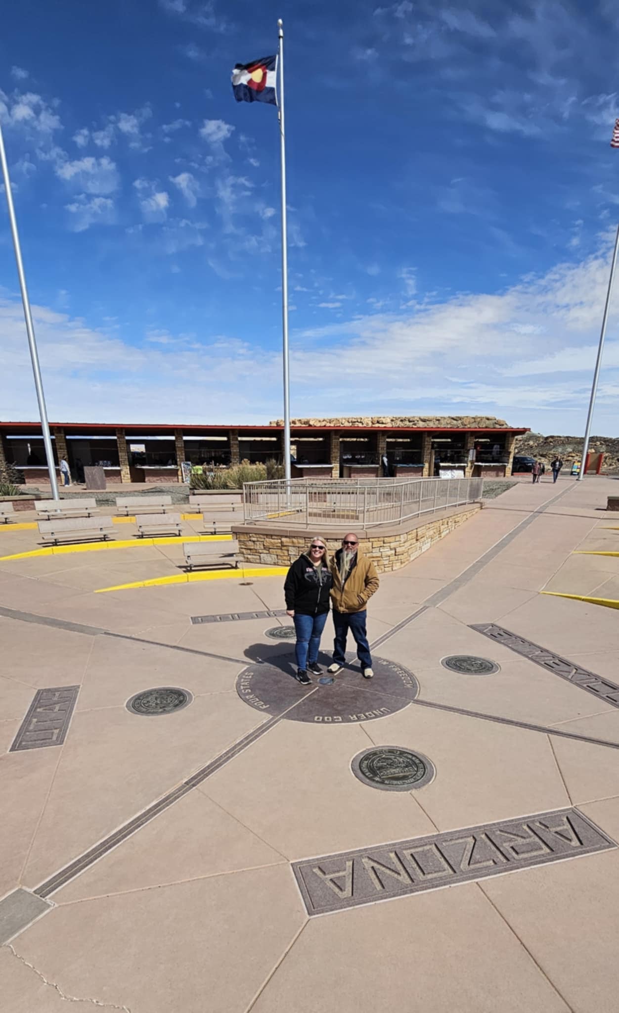
Four states. One slab of granite. Four Corners Monument is the only point in the United States where four state borders meet at a single spot — Arizona, New Mexico, Utah, and Colorado, all converging at a bronze disk set into the ground on Navajo Nation land. The concept is simple and the execution is completely ridiculous, and we were fully on board for all of it.

The move, of course, is to stand on the marker with one hand or foot in each state and have someone take the photo. Joe did it. Tina did it. We took the photos. We have the evidence. There is something genuinely funny about standing in four states simultaneously while a line of strangers waits their turn to do the exact same thing — and everyone is smiling the whole time because it is impossible not to.

The drive in is part of the experience. The high desert out here is wide open and dramatic — sandstone buttes rising from the flat scrubland, the sky going on forever, the kind of landscape that makes you feel like you're in a Western even when you're just driving a truck. The Chimney Rock formation on the approach is a full stop on its own. And somewhere along the road, a prairie dog popped up and held still long enough to get photographed, which felt like a bonus.

The Navajo vendors set up around the monument sell jewelry, fry bread, and souvenirs, and the whole place has a relaxed, unhurried energy. It's a quick stop by design — you come, you stand in four states, you take the photo, you buy something from a vendor, and you get back on the road. But it earns its place on the list.

Four Corners Monument, Colorado. LOVING LIFE HAVING FUN — one foot in four states at once.

Four Corners Monument, Colorado · 10 photos

Showing 4 of 10 photos

Canyons of the Ancients National Monument, Dolores, Colorado

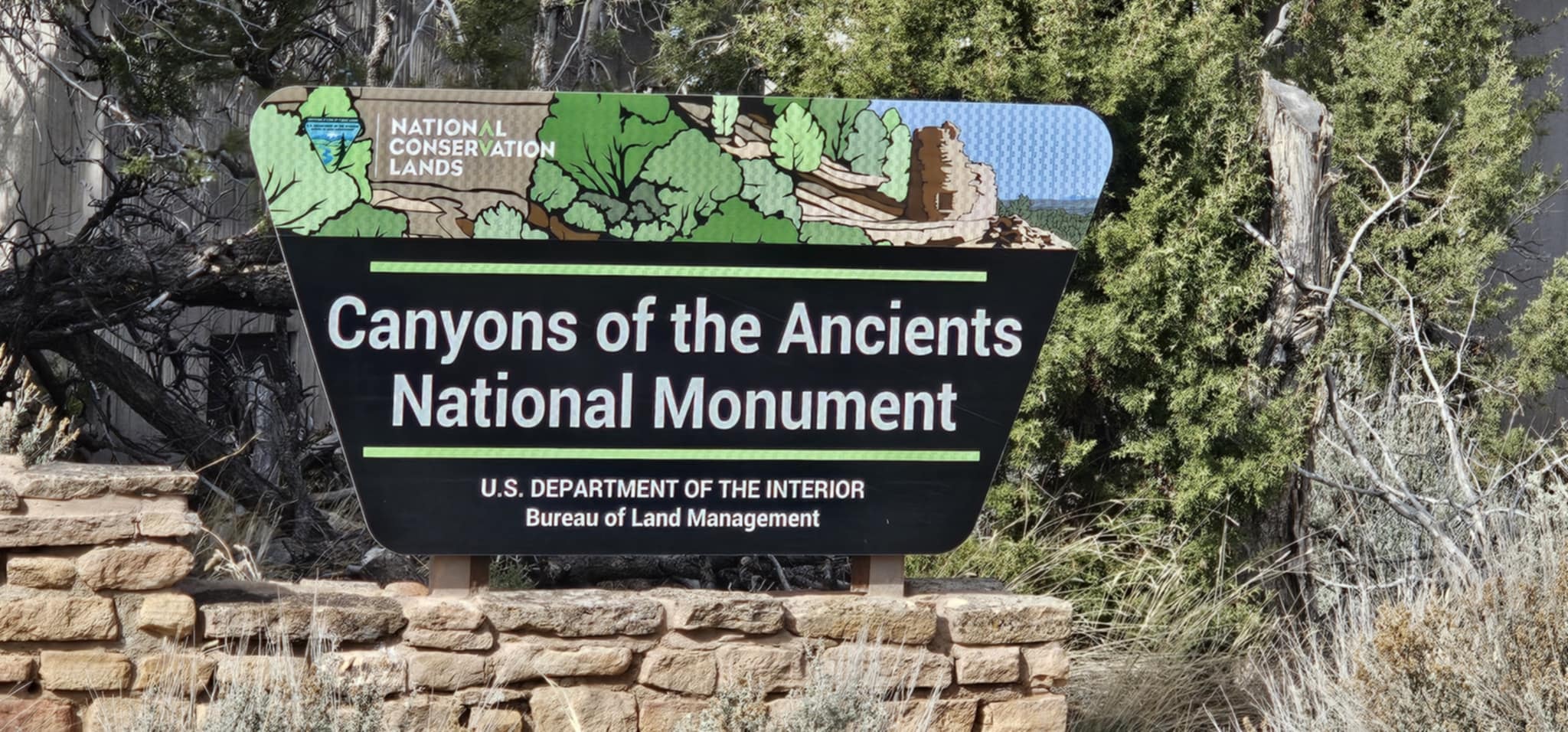
Canyons of the Ancients National Monument holds the highest known density of archaeological sites in the United States — over 6,000 recorded sites packed into a single stretch of southwestern Colorado mesa country. That number is not a typo. More ancient sites per square mile here than anywhere else in the country. Ancestral Puebloan people built communities, farmed, traded, and thrived across this landscape for centuries, and what they left behind is still out there — towers, cliff dwellings, kivas, petroglyphs, pottery fragments scattered across the high desert scrub like the land never forgot.

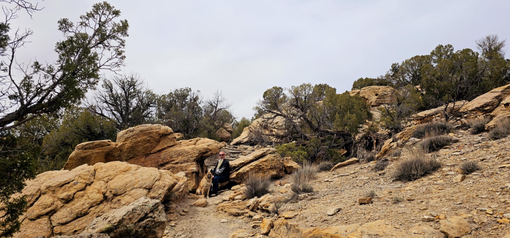
This is not a polished national park experience. There are no shuttle buses, no gift shops at every overlook, no guardrails between you and a thousand years of history. It is Bureau of Land Management country — raw, remote, and real. You navigate dirt roads, follow trail markers through juniper and sage, and suddenly you are standing inside a stone room that someone built by hand in the 1200s. The walls are still standing. The doorways are still shaped. The silence is complete.

Zero and Reecee were with us for all of it, and Canyons of the Ancients is genuinely dog-friendly in a way that most archaeological sites are not. Dogs on leash are welcome on the trails and throughout the monument — so both of them got to walk the same ground, noses to the same ancient stones, and generally act like they personally discovered every ruin. They were not wrong. The kiva entry holes got a thorough sniff inspection from Zero. Reecee patrolled the museum corridor with the focused energy of a dog who takes her job seriously. Both approved.

The Anasazi Heritage Center in Dolores is the anchor for the whole visit — a serious museum with actual artifacts, interpretive exhibits, and the context you need to understand what you are looking at out on the land. Joe spent a long time in there. Tina spent a long time in there. Zero and Reecee waited outside with the patience of dogs who know there will be more ruins after this.

Canyons of the Ancients National Monument, Dolores, Colorado. LOVING LIFE HAVING FUN — on the ground where the ancient ones built something that lasted.

Canyons of the Ancients National Monument, Dolores, Colorado · 20 photos

Showing 4 of 20 photos

Mesa Verde National Park, Cortez, Colorado

Map

There is no adequate way to prepare for Mesa Verde. You drive up onto the mesa, you round a bend, and suddenly there are entire stone cities built into the cliff faces — rooms, towers, kivas, doorways — tucked into sandstone alcoves hundreds of feet above the canyon floor. People built this. By hand. In the 1200s. And it is still standing. That is the thing that keeps hitting you as you walk the overlooks: the sheer, quiet fact of it.

Cliff Palace is the one that gets you first. It is the largest cliff dwelling in North America — over 150 rooms and 23 kivas stacked into a single alcove, with towers rising to the ceiling of the overhang. You stand at the overlook across the canyon and just stare. Then you walk down into it on the ranger tour and realize the scale is even more disorienting up close. The walls are still plastered. The doorways are still shaped to fit a person. The kiva entry holes are still open in the floor. It is not a ruin. It is a neighborhood that has been empty for 700 years.

Balcony House is the one that earns it. The access requires crawling through a 12-foot tunnel, climbing a 32-foot ladder up a sheer cliff face, and squeezing through a narrow rock passage on the way out. It is not for the faint of heart — and it is completely worth it. The dwelling itself is perched on a natural balcony with a sheer drop below and the canyon spreading out in every direction. Spruce Tree House is more accessible and no less stunning — a 130-room community tucked into a curved alcove with cottonwood trees growing at the base.

The mesa top tells the earlier story. The pit house villages date back to 600 AD — circular underground rooms with hearths, ventilator shafts, and sipapus, the ceremonial openings to the underworld. The interpretive panels are genuinely good. Joe spent a long time at the Sun Temple, a massive D-shaped ceremonial structure on the mesa rim that was never finished — construction stopped abruptly around 1276, right before the great drought that ended everything. You stand there and feel the weight of that.

Zero and Reecee were along for the mesa top portions — the canyon overlooks, the fire lookout at Park Point, the wide open sky above the Montezuma Valley with the La Plata Mountains stacked up to the north. The view from the fire lookout is one of the great panoramics in the Southwest. The whole Colorado Plateau laid out in every direction, and somewhere down in those cliffs, rooms that have been standing since before Columbus.

Mesa Verde National Park, Cortez, Colorado. LOVING LIFE HAVING FUN — standing in the doorway of something that has no business still being here, and being grateful that it is.

Mesa Verde National Park, Cortez, Colorado · 99 photos

Showing 4 of 99 photos

Hovenweep National Monument, Cortez, Colorado

Map

Hovenweep National Monument is one of the Southwest's best-kept secrets, and it earns that description every time. Scattered across the Utah-Colorado border in the high desert scrub, these Ancestral Puebloan towers have been standing since the 1200s — square, round, D-shaped, and oval, perched on canyon rims and boulder tops with a precision that still defies easy explanation. Nobody talks about Hovenweep the way they talk about Mesa Verde. That is exactly why you should go.

The Square Tower Group is the centerpiece — Hovenweep Castle, Twin Towers, Rimrock House, Stronghold House — a full loop trail that delivers one jaw-dropping ruin after another without a single guardrail between you and 800 years of history. The canyon drops away below the towers and the San Juan Mountains stack up in the distance. In winter, snow on those peaks behind the ruins makes for a photograph that looks completely made up.

Hovenweep is genuinely dog-friendly — leashed dogs are welcome on the trails throughout the monument, and Zero and Reecee made the most of it. Zero picked his way across the sandstone boulders with the focused energy of a dog who takes trail work seriously. Reecee found every rocky scramble passage on the loop and navigated them with zero hesitation and maximum enthusiasm. Both of them paused at the canyon rim overlooks long enough to suggest they understood what they were looking at. They probably did.

The trail is not crowded. That is the other thing about Hovenweep — you can stand next to a tower that has been standing since before the Magna Carta and have it entirely to yourself. No shuttle buses. No timed entry. Just the ruins, the canyon, the dogs, and the high desert going quiet in every direction.

Hovenweep National Monument, Cortez, Colorado. LOVING LIFE HAVING FUN — on the canyon rim where the towers have been standing since the 1200s and the dogs approved of every inch of it.

Hovenweep National Monument, Cortez, Colorado · 19 photos

Showing 4 of 19 photos

Great Sand Dunes National Park, Alamosa, Colorado

Great Sand Dunes National Park is one of the most surreal landscapes in all of North America — and it never gets old. The tallest sand dunes in North America rise up to 750 feet against the Sangre de Cristo Mountains, built over thousands of years as wind carried sand from the San Luis Valley floor and stacked it against the range. The result looks like it belongs on another planet. You drive across the flat valley floor, the mountains ahead, and then suddenly there are dunes. Massive, impossible dunes. It stops you every single time.

Medano Creek runs along the base of the dunes in spring and early summer — a shallow, sandy-bottomed stream that creates a natural wading beach at the foot of the tallest dunes in the country. The surge flow pulses in waves as sand dams break and reform upstream, which means the water actually moves in rhythmic pulses across your feet. It is one of the stranger and more delightful natural phenomena you will encounter anywhere in the Southwest.

Great Sand Dunes is genuinely dog-friendly — leashed dogs are welcome throughout the park, including on the dunes themselves. Zero and Reecee made the most of every inch of it. Zero took the dune climbing seriously, working up the face with the focused determination of a dog who has decided this is a mission. Reecee treated the whole thing as a personal playground — sprinting up the slip face, skidding back down, shaking sand everywhere, and immediately doing it again. Both of them hit Medano Creek like it was the best thing that had ever happened to them, which, in the moment, it probably was.

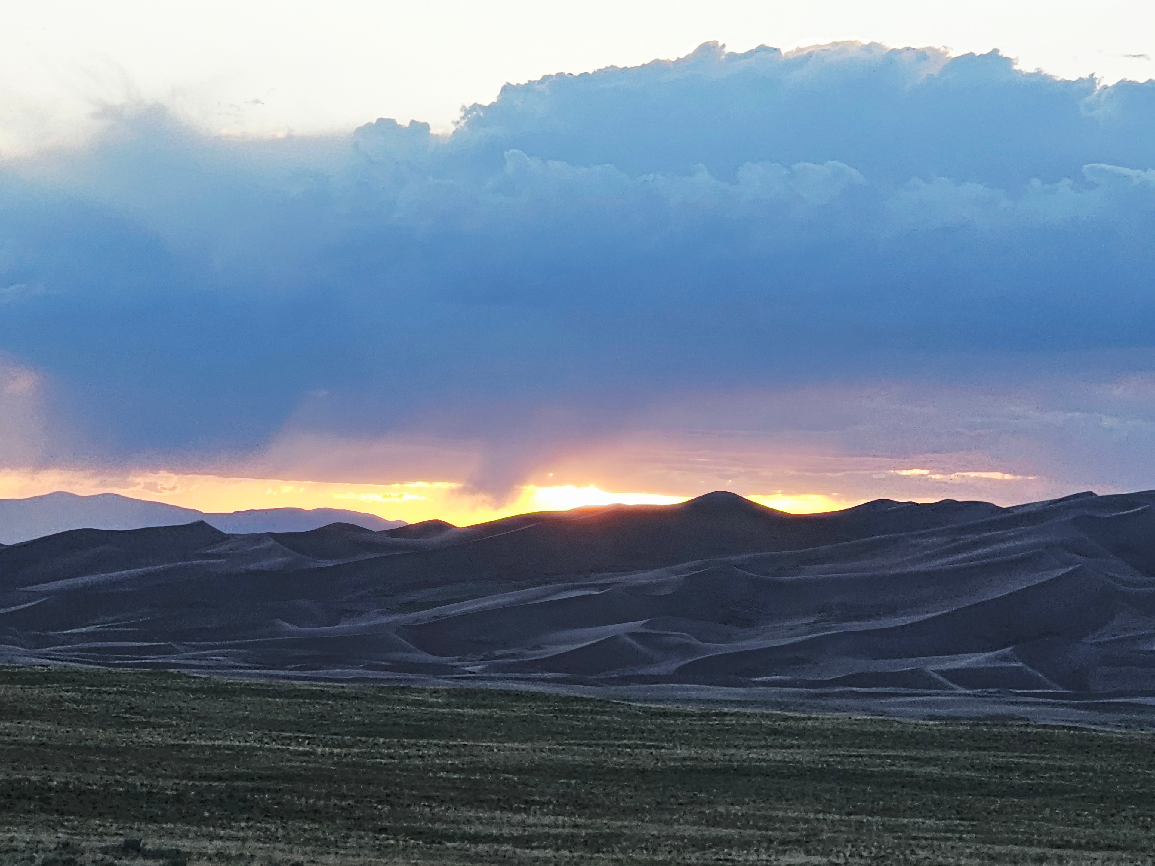
The light at Great Sand Dunes is something else entirely. The dunes change color by the hour — pale gold in the morning, deep amber in the afternoon, and at sunset the shadows cut across the slip faces in long geometric lines that make the whole field look sculpted. When a storm rolls in over the Sangre de Cristos and the sun drops below the clouds at the last moment, the dunes go orange and the sky goes fire. Joe and Tina have chased that light more than once. It is worth every minute of waiting.

Great Sand Dunes National Park, Alamosa, Colorado. LOVING LIFE HAVING FUN — climbing the tallest dunes in North America with two dogs who thought the whole thing was built specifically for them.

Great Sand Dunes National Park, Alamosa, Colorado · 47 photos

Showing 4 of 47 photos

Zapata Falls, Alamosa, Colorado

Map

A shoutout is required here before anything else: our friend Chris made this one happen. He had timed his travels to intersect with ours near Great Sand Dunes, and when he suggested Zapata Falls, we said yes immediately. That is the thing about traveling with good people — they know about places you haven't found yet, and they show up at exactly the right moment. Chris, this one's for you.

Zapata Falls is tucked up into the San Isabel National Forest above the San Luis Valley, about a mile from the Great Sand Dunes Oasis. The trailhead is a short hike from the parking area, and the approach through the canyon gives you no indication of what's waiting. You follow the stream into a narrowing rock gorge, the walls close in, and then you're wading through cold rushing water into a cave passage. Squeeze through, and there it is — a 25-foot waterfall dropping through a crack in the mountain into a dark grotto. It is one of those places that genuinely surprises you, even when you know it's coming.

The dogs were completely in their element. Zero and Reecee hit the stream like they'd been waiting for it all day — wading, scrambling over boulders, shaking water everywhere. Mac, Chris's dog, was right there with them, and the three of them turned the whole canyon into their personal playground. Joe and Zero made it all the way into the cave interior. Reecee found every possible wet surface and used all of them.

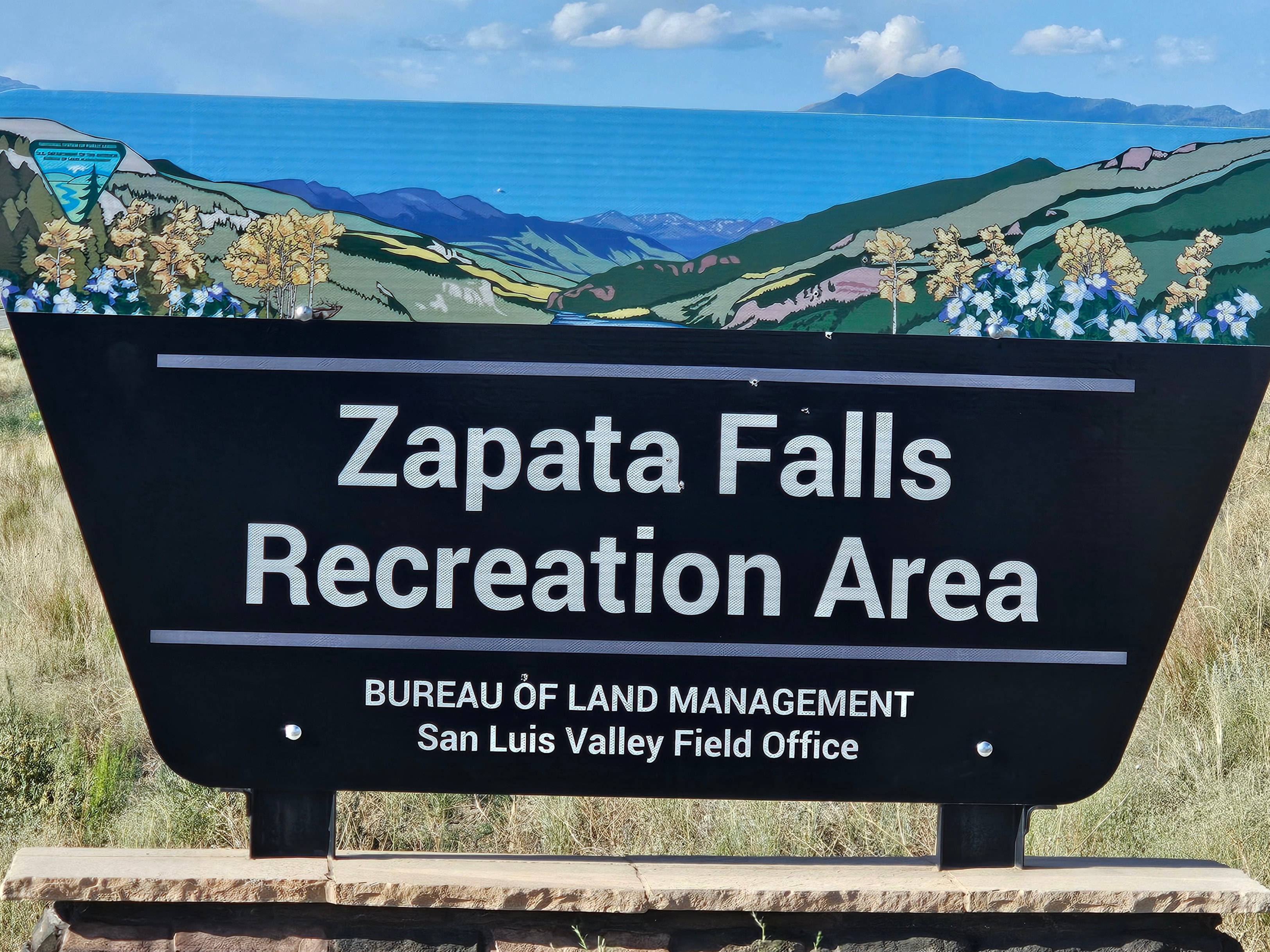
The canyon itself is worth the trip even before you get to the waterfall — layered rust and gold rock walls, the stream running cold and clear over rounded boulders, the sound of the water echoing off the stone. The BLM manages the recreation area and it's free, dog-friendly on leash, and genuinely one of the better-kept secrets in the Alamosa area.

Zapata Falls, Alamosa, Colorado. LOVING LIFE HAVING FUN — wading into a mountain cave with good friends and three very wet, very happy dogs.

Zapata Falls, Alamosa, Colorado · 23 photos

Showing 4 of 23 photos

The Million Dollar Highway, Ouray, Colorado

Map

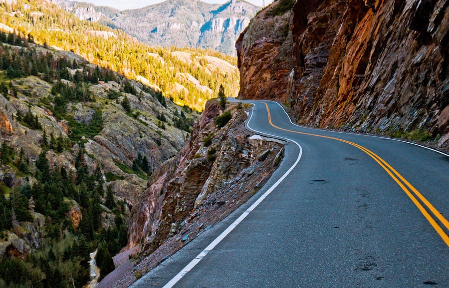
The Brinkley did not drive the Million Dollar Highway. Let's get that out of the way first. US-550 between Silverton and Ouray has no guardrails on significant stretches, sheer drop-offs measured in hundreds of feet, and switchbacks carved directly into cliff faces at elevations above 11,000 feet. That is a job for a smaller vehicle with a driver who has made peace with the concept of exposure. Joe and Tina took the truck. The views were worth every white-knuckle moment.

The road earns its name from every angle. The San Juan Mountains here are not subtle — they are massive, layered, and in places stained deep orange and rust red from iron-rich mineral deposits that streak the cliff faces like something out of a geology textbook. The aerial mine structures clinging to the slopes above the road are a constant reminder that people once worked these mountains at altitude, in winter, with equipment hauled up on mules. The headframes and ore chutes and collapsed buildings are still up there, slowly returning to the mountain.

The waterfalls come without warning. A cliff face that looked solid suddenly has white water sheeting down it, crossing under the road, and disappearing into the canyon below. The spruce forest crowds the road on the uphill side and drops away on the downhill side into nothing. The switchbacks are exactly as advertised — tight, steep, and completely committed. There is no hesitation on the Million Dollar Highway. You go.

Ouray is the reward at the north end. Called the Switzerland of America, and the comparison holds — a tiny Victorian mining town tucked into a box canyon with 14,000-foot peaks rising straight up on all sides. The town is colorful, compact, and completely surrounded by mountains that make you feel like the walls are closing in, in the best possible way. The Ouray Lookout Point pullout gives you the full picture: the town below, the canyon walls above, and the road you just survived snaking back toward Silverton.

The Million Dollar Highway, Ouray, Colorado. LOVING LIFE HAVING FUN — on one of the most spectacular roads in America, with the windows down and the drop-offs very much present.

The Million Dollar Highway, Ouray, Colorado · 42 photos

Showing 4 of 42 photos

Garden of the Gods, Colorado Springs, Colorado

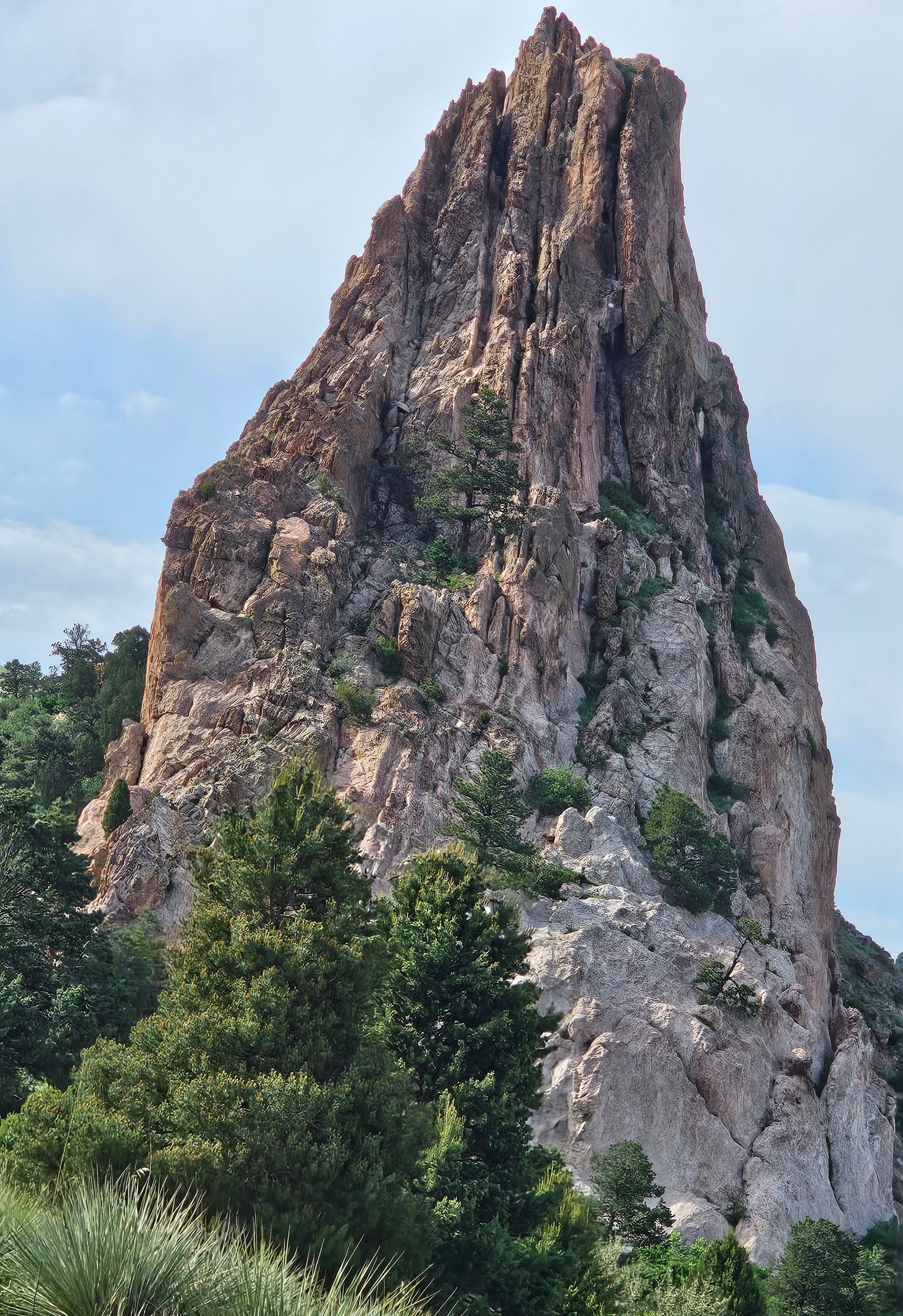
Garden of the Gods is a National Natural Landmark just outside Colorado Springs where massive red sandstone formations rise hundreds of feet straight out of the earth with Pikes Peak sitting snow-capped behind them like the whole scene was staged. It was not staged. It is just like that. The geology here is the result of millions of years of uplift, tilting, and erosion — ancient seabed rock pushed vertical by the same forces that built the Rockies, then carved by wind and water into fins, arches, spires, and balanced boulders that have no business still standing. And it is completely free to enter.

The formations change character depending on where you stand and what the light is doing. The twin red fins framing a gap with Pikes Peak in the distance is one of the great landscape compositions in Colorado. The arch windows cut through solid sandstone walls and frame blue sky beyond. The pale limestone formations on the north end of the park are a different texture entirely — smooth, cream-colored, jagged along the ridgeline — and they catch the afternoon light differently than the red rock. Walking the main loop trail, you keep stopping because something new has come into view and you need a minute with it.

Garden of the Gods is genuinely dog-friendly — leashed dogs are welcome on all the trails, and the whole crew made the most of every inch of it. Reecee found every rocky scramble passage and navigated them with her usual zero-hesitation approach. Zero covered ground at his own pace, which is to say thoroughly and without apology. Joe and Tina spent a long time at the dedication plaque boulder near the visitor center entrance — the park was donated to the City of Colorado Springs in 1909 with the explicit condition that it remain free to the public forever. That is a good human decision that has held up.

The light at golden hour turns the red formations deep amber and the shadows cut long geometric lines across the meadow. The twin spires catch the last sun while the valley below goes dark. Pikes Peak sits behind everything, permanent and enormous. It is the kind of place that makes you feel like Colorado is showing off on purpose.

Garden of the Gods, Colorado Springs, Colorado. LOVING LIFE HAVING FUN — on the trails where the red rock goes vertical and Pikes Peak watches from behind.

Garden of the Gods, Colorado Springs, Colorado · 26 photos

Showing 4 of 26 photos

Manitou Cliff Dwellings, Manitou Springs, Colorado

Map

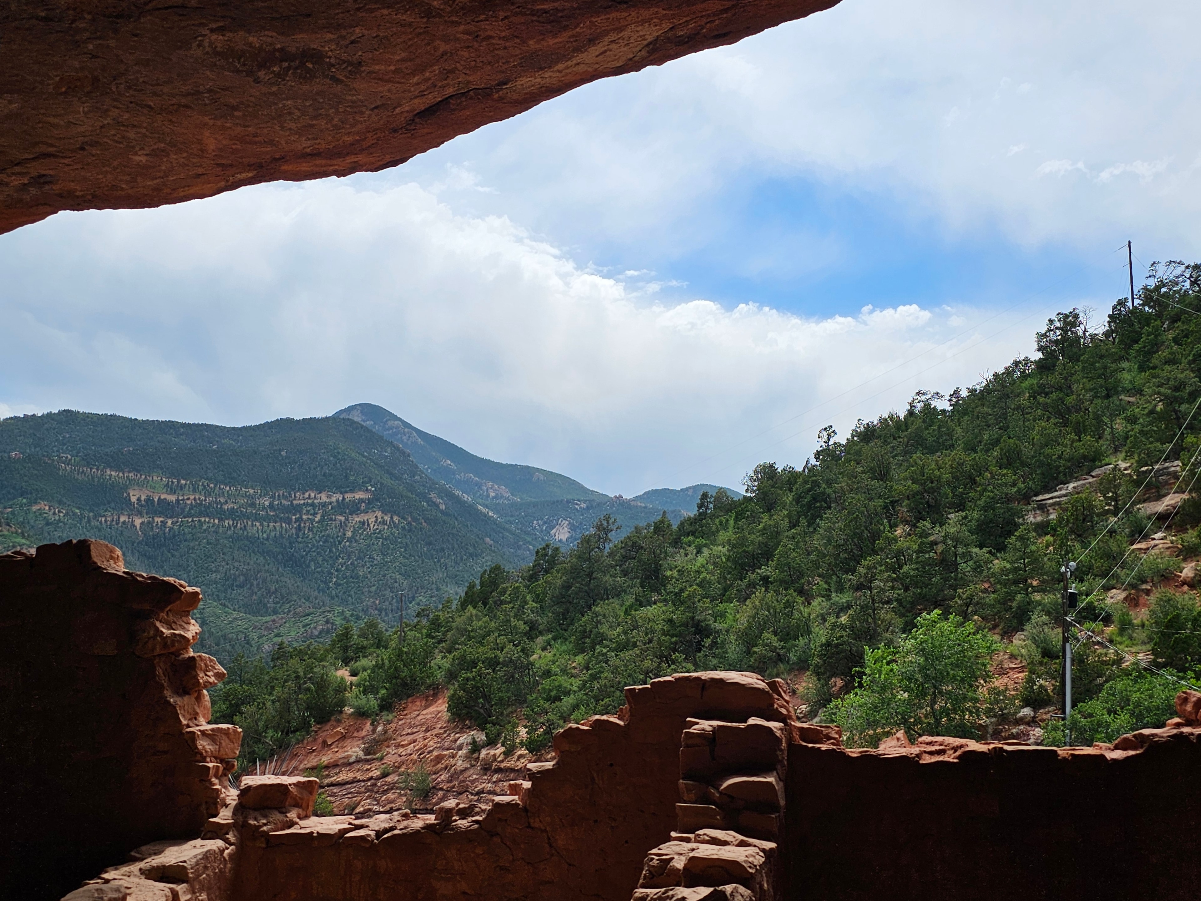
The Manitou Cliff Dwellings are tucked into a red sandstone alcove just outside Colorado Springs, and they are one of the most accessible and genuinely dog-friendly ancient sites in the entire Southwest. These are real Ancestral Puebloan structures — relocated and preserved here in the early 1900s — and you can walk directly through them. Into the rooms. Under the overhangs. Through the cave passages. Up close to masonry that has stood for nearly a thousand years. The setting alone is worth the drive: a deep red cliff face, a natural alcove, green forested mountains framing the whole scene, and the Pikes Peak region spread out behind it.

The dwellings themselves are extraordinary up close. Multi-story adobe walls with square windows looking out at the canyon. Kiva entry holes in the floor, still open, still round, still exactly as they were built. Wooden ladders leaning against stone walls. Metates — the grinding stones — still sitting on the clay floor where they were left. Cave passages that require you to duck and squeeze, which Joe did with full commitment. Reecee photobombed the cave interior shot so thoroughly that she is now the official face of the passage. This is documented.

Dogs are welcome on leash throughout the site, which is not something you can say at most ancient ruins in the Southwest. Zero and Reecee made the most of every inch of it. Zero climbed the wooden stairs with the focused energy of a dog who takes historic preservation seriously. Reecee found the kiva entry hole and sniffed it with the intensity of someone who suspects something important happened there. She is not wrong. Joe crawled through the low cave passage with Reecee right behind him, which is either a testament to her loyalty or her complete inability to let anyone go anywhere without her. Probably both.

The museum and grounds also include a tipi, a pueblo building with vigas and traditional signage, and a gift shop built into the red rock. The whole complex sits against the cliff face in a way that makes the ancient and the modern feel genuinely connected rather than awkward. It is one of those places that rewards slowing down — the more time you spend looking at the walls, the more you notice.

Manitou Cliff Dwellings, Manitou Springs, Colorado. LOVING LIFE HAVING FUN — crawling through cave passages with two dogs who were absolutely certain they were supposed to be there.

Manitou Cliff Dwellings, Manitou Springs, Colorado · 30 photos

Showing 4 of 30 photos

North Pole – Home of Santa's Workshop, Cascade, Colorado

Map

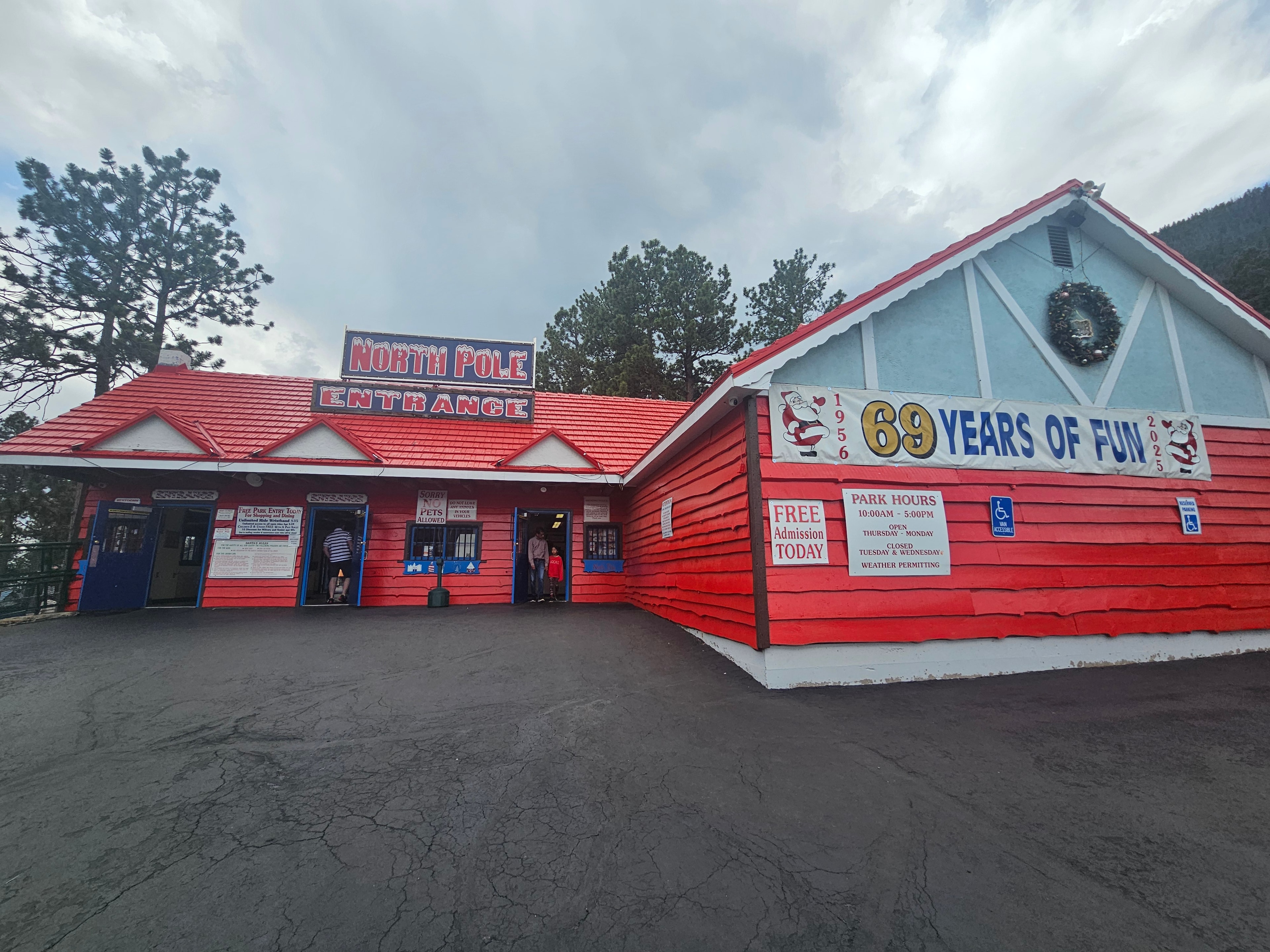
We did not plan this one. We were driving through Cascade, Colorado on the way to Garden of the Gods, and there it was — North Pole – Home of Santa's Workshop sitting at the base of Pikes Peak like it had always been there, which it has, since 1956. The sign said "69 Years of Fun." We pulled in immediately.

The place is exactly what it sounds like and somehow more. Candy cane lamp posts, hand-painted storefronts, a working US Post Office with a North Pole, Colorado postmark, a glass blowers shop, Santa's Chapel, the North Pork restaurant, and rides that look like they were built in 1962 and have been running ever since. The whole park sits at around 7,500 feet elevation in the shadow of Pikes Peak, which means even in July the air has a bite to it. That part is not a gimmick — it genuinely feels like the North Pole.

Santa was there. Not a seasonal appearance — he lives there. We waited in line with a bunch of kids who were absolutely losing their minds, and honestly Joe was right there with them. Tina took the photos. The elves were in character. The whole operation runs like it has been doing this for seven decades because it has.

The vintage rides are the real charm. The sleigh ride, the carousel, the little train that loops the property — none of it is trying to be a theme park. It is a family attraction that has stayed exactly what it was built to be, and that is rarer than it sounds. Zero and Reecee waited in the truck for this one, which was the right call, but they got extra treats after.

If you are anywhere near Colorado Springs and you have even a passing tolerance for joy, North Pole – Home of Santa's Workshop is worth the detour. It is one of those places that makes you feel like a kid again whether you want to or not.

North Pole – Home of Santa's Workshop, Cascade, Colorado · 16 photos

Showing 4 of 16 photos

Museum of the Mountain West, Montrose, Colorado

Map

History doesn't have to be stuffy — and the Museum of the Mountain West in Montrose, Colorado proves it. This open-air living history museum spreads across several acres and is packed with authentic frontier buildings, vintage storefronts, period medical offices, a Victorian saloon, a working church with a bell you can actually ring, a print shop, a blacksmith, a carriage barn, and more artifacts from the American West than you can absorb in a single visit. We spent hours here and still felt like we missed things.

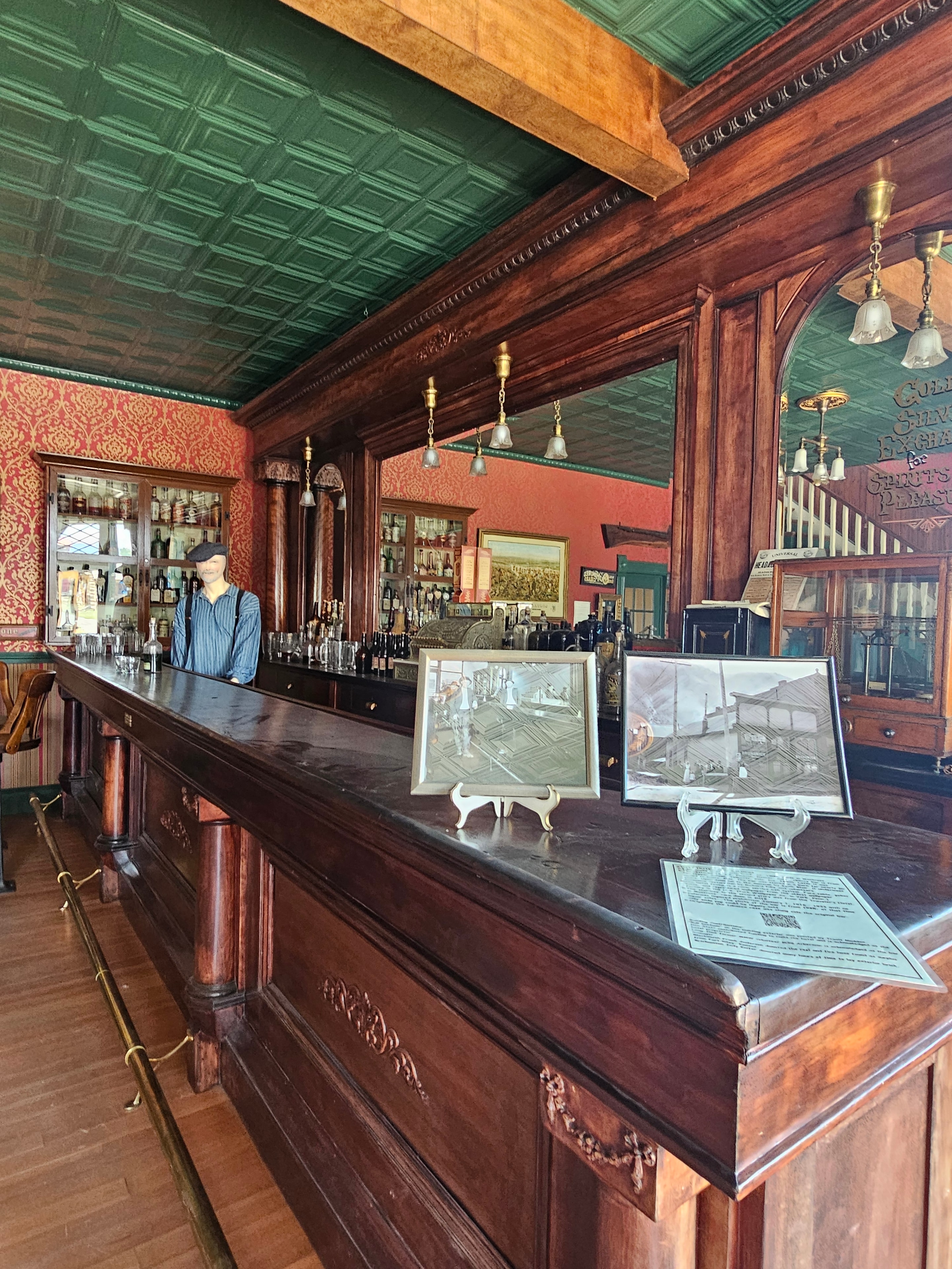
The indoor storefronts are the real draw. Furman's Drug Store since 1890. Holland's Dry Goods. Anthony Hoag Dentist. A Victorian barber shop with a red chair and blue wallpaper that looks like it closed last Tuesday. The saloon has a full mahogany bar with a mirror back, brass fixtures, red damask walls, a pool table, a poker table, and two Wurlitzer jukeboxes — a 1946 Model 1015 and a 1947 Model 1100 — sitting side by side like they're waiting for a quarter. Zero walked right into the Feed & Grain storefront like he owned the place. Nobody stopped him.

Outside, the grounds are just as good. Weathered log buildings, a red chapel, wagon wheels, a livestock trailer, a blacksmith shop with the forge still set up, a frontier church with actual stained glass and a bell Tina rang while Reecee supervised from below. The carriage barn has a full collection of antique carriages and horseshoes. There is a two-story building where Zero stuck his head out a second-floor window and looked extremely pleased with himself.

Here is the thing that makes this stop worth calling out specifically: the Museum of the Mountain West is genuinely dog friendly — inside and outside. Zero and Reecee were welcome in the storefronts, the church, the storage rooms, the carriage barn, all of it. Reecee posed next to the saddle and tack display like she was considering a purchase. Zero explored a narrow storage room with a rag rug and vintage machinery and came out looking satisfied. If you have dogs and you are anywhere near Montrose, this one is a no-brainer.

Museum of the Mountain West, Montrose, Colorado · 90 photos

Showing 4 of 90 photos

Ute Indian Museum, Montrose, Colorado

Map

Right in Montrose, just a short drive from the Museum of the Mountain West, sits one of the most meaningful stops we made in Colorado. The Ute Indian Museum is a Colorado state history museum dedicated entirely to the Ute people — the original inhabitants of this land — and it does not feel like a dusty archive. It feels alive.

The collection inside is extraordinary. Feathered headdresses and war bonnets in glass cases. Beaded saddles and fringed leather. Traditional buckskin dresses, moccasins, and children's clothing. An ancient coiled basket water jug with horsehair binding that has survived longer than any building in Montrose. And then there is the hide painting — animals, birds, and human figures rendered in ink and watercolor on animal skin — that stopped us cold in the middle of the room. You do not walk past that one. You stand there.

Outside, the grounds are just as worth your time. Three tipis stand on the lawn, one decorated with traditional Ute figures. A bronze bear sculpture sits on a boulder in the garden. A peace pole from a 2016 community gathering carries signatures and white feathers. And at the back of the property, behind a green iron fence surrounded by wildflowers, is the grave of Chipeta — the Ute peace leader who worked alongside her husband Chief Ouray to negotiate with the U.S. government in the 1870s. Nearby is the grave of Chief John McCook, 1937. These are not historical footnotes. They are people who were here, who fought for this land, and who are still honored on it.

The Ute Indian Museum is worth the stop every time we are in Montrose. If you are already planning to hit the Museum of the Mountain West, add this one to the same day. It is a short drive and a completely different kind of experience — one that stays with you.

Ute Indian Museum, Montrose, Colorado · 18 photos

Showing 4 of 18 photos

Telluride, Colorado

Map

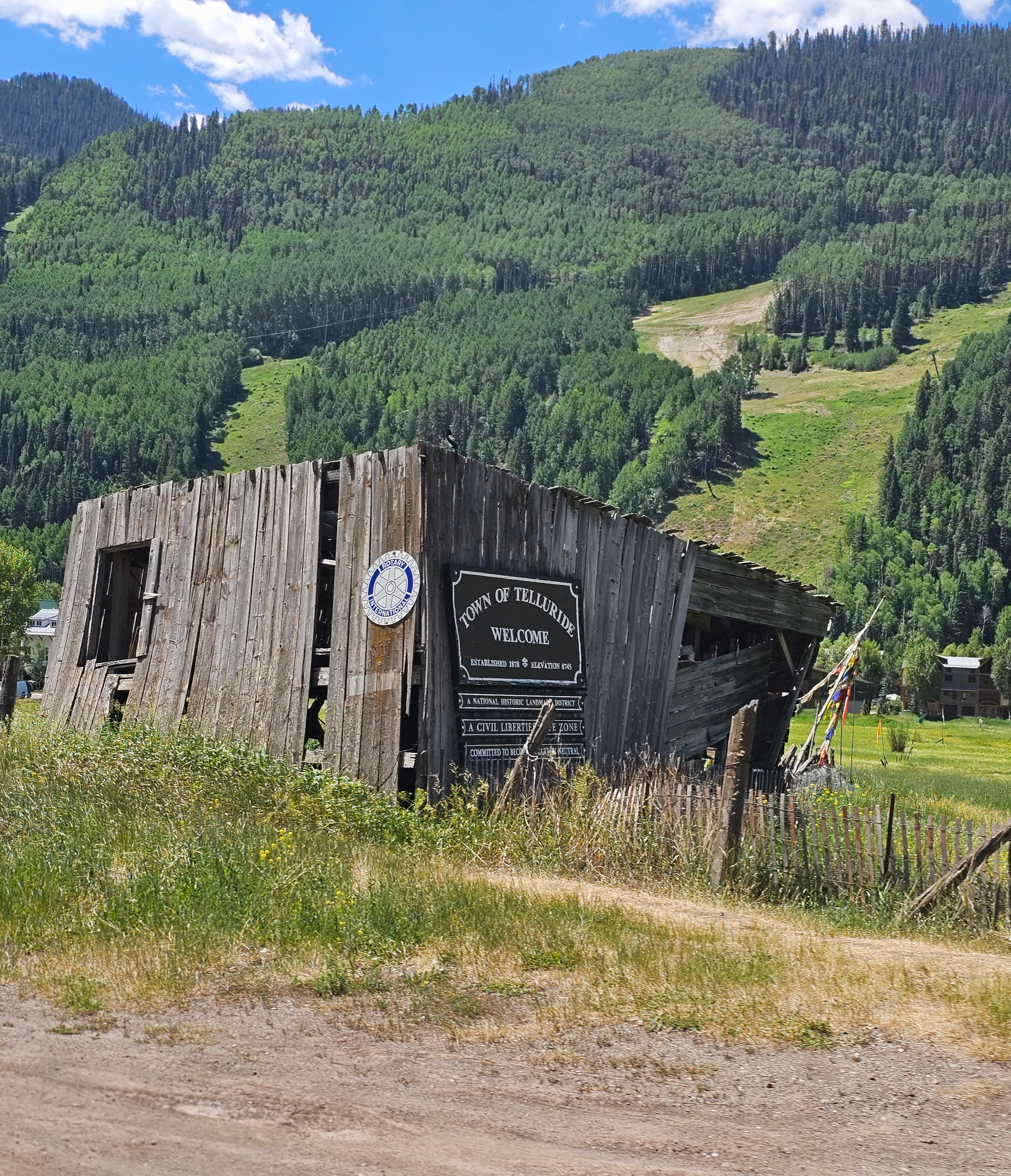
Telluride is one of those towns that earns every bit of its reputation — and then some. Tucked into a box canyon in the San Juan Mountains, it is a National Historic Landmark District with Victorian storefronts, world-class skiing, and a free gondola that connects the town to Mountain Village. The gondola is free. The views are unreal. And dogs ride free too.

Zero and Reecee rode the gondola. Both of them. Up to Mountain Village at 10,540 feet, looking out over the San Juan Mountains with their tongues out and absolutely no concept of how lucky they are. Reecee had her face pressed against the gondola window the whole way up. Zero was doing his usual thing — calm, dignified, completely unbothered, as if riding a gondola over a 10,000-foot mountain range is just a normal Tuesday. It is not a normal Tuesday. It was one of the best Tuesdays.

The dog-friendly situation in Telluride goes well beyond the gondola. The trails are open to leashed dogs. The main street welcomes them. The mountain village plaza welcomes them. We walked the whole town with both dogs and nobody batted an eye — in fact, people stopped us constantly to say hello to Reecee and Zero, which is the correct response. Bridal Veil Falls is a short drive up the canyon and the views of the power station perched on the cliff above the falls are worth the trip on their own.

The mountain coaster at Purgatory Resort is about 45 minutes south and worth adding to the same trip. Joe rode it twice. Tina rode it once and was laughing the whole way down. The chairlift at Purgatory runs in summer and takes you up into the San Juan high country — the kind of scenery that makes you stop talking mid-sentence because there is nothing useful to say.

Telluride is the kind of place that makes you want to stay longer than you planned. We keep coming back.

Telluride, Colorado · 33 photos

Showing 4 of 33 photos

Grand Mesa National Forest, Colorado

Map

Grand Mesa is one of the largest flat-top mountains in the world, and it sits right here in Colorado — over 10,000 feet up, blanketed in spruce and fir forest, dotted with more than 300 lakes and reservoirs. We drove up through the aspens, past the Grand Mesa National Forest entrance sign, and into a landscape that felt like the top of the world. The air changes the moment you get up there. It gets cooler, quieter, and the trees close in around you in the best possible way.

The lakes are everywhere. Crystal-clear alpine water surrounded by spruce, wildflowers pushing up through the rocky ground, and the kind of reflections that make you stop the truck and just stand there for a minute. We found one lake with a mirror-perfect reflection of the treeline and dramatic storm clouds building behind it — the kind of shot that looks fake but isn't. Joe and Zero walked the forest trails while Reecee supervised from the truck, which is her preferred management style.

The wildlife on the Grand Mesa is worth calling out. Yellow-bellied marmots were out on the rocky ledges, completely unbothered by us. We spotted them twice — once sitting up on a boulder like they owned the place, which they do. Cattle graze the open meadows up here on summer range, and we came around a bend and found a whole herd spread out across a green hillside with the Cimarron Ridge behind them. That is a view that does not get old.

The drive itself is part of the experience. The road winds through aspen groves, past stone ruins, through meadows full of sunflowers, and up to the summit sign at 10,114 feet on the Uncompahgre National Forest boundary. The Cimarron Ridge — that jagged wall of rock that runs along the southern edge — shows up in almost every direction you look. On a clear day you can see for miles. On a stormy day the clouds roll in fast and the whole mesa goes moody and dramatic in about ten minutes.

Grand Mesa National Forest is one of those places that rewards slowing down. Take the side roads. Stop at the lakes. Let the marmots judge you. It is worth every mile.

Grand Mesa National Forest, Colorado · 28 photos

Showing 4 of 28 photos

Owl Creek Pass, Ridgway, Colorado

Map

Owl Creek Pass is one of the most spectacular and least-traveled mountain passes in the entire San Juan range — a high-altitude dirt road that winds through aspen groves, open meadows, and rugged alpine terrain between Ridgway and the Cimarron Valley. At 10,114 feet on the Uncompahgre National Forest boundary, this is the kind of road that rewards the adventurous. No guardrails. No crowds. No cell service. Just the Cimarron Ridge, the open sky, and the feeling that you found something most people drive right past.

The drive starts down in the valley with sunflowers lining the road and ranch fences running along the hillsides, the Cimarron Ridge building in the distance. As you climb, the aspens close in, the air cools, and the road narrows to a single lane of packed gravel. We came around a bend and found a whitewater creek running alongside the road through a mossy canyon — the kind of scene that makes you stop the truck and just stand there for a minute. Zero approved. Reecee was already in the water.

Higher up, the terrain opens into wide meadows with the jagged Cimarron Ridge dominating the skyline. The ridge is dramatic in a way that photographs don't fully capture — a long, serrated wall of rock running east to west with spruce forest climbing its lower slopes and bare stone above the treeline. We found a mirror-still pond up there that reflected the ridge and the clouds perfectly. Joe got out and walked around it. Zero followed. Nobody said anything for a while.

The summit sign sits right at the Uncompahgre National Forest boundary — elevation 10,114 feet — and the views from up there stretch in every direction. Rocky peaks, spruce forest, open meadow, and the Cimarron Valley below. Stone ruins from an old homestead or line camp sit along the road partway up, half-swallowed by the vegetation. A rustic cabin tucked into an aspen grove looked like it had been there since the 1940s and might last another hundred years.

Owl Creek Pass is a half-day adventure out of Ridgway that most people skip because it's a dirt road and it's not on the main tourist circuit. That's exactly why it's worth doing.

Owl Creek Pass, Ridgway, Colorado · 25 photos

Showing 4 of 25 photos

Rifle Falls State Park, Rifle, Colorado

Map

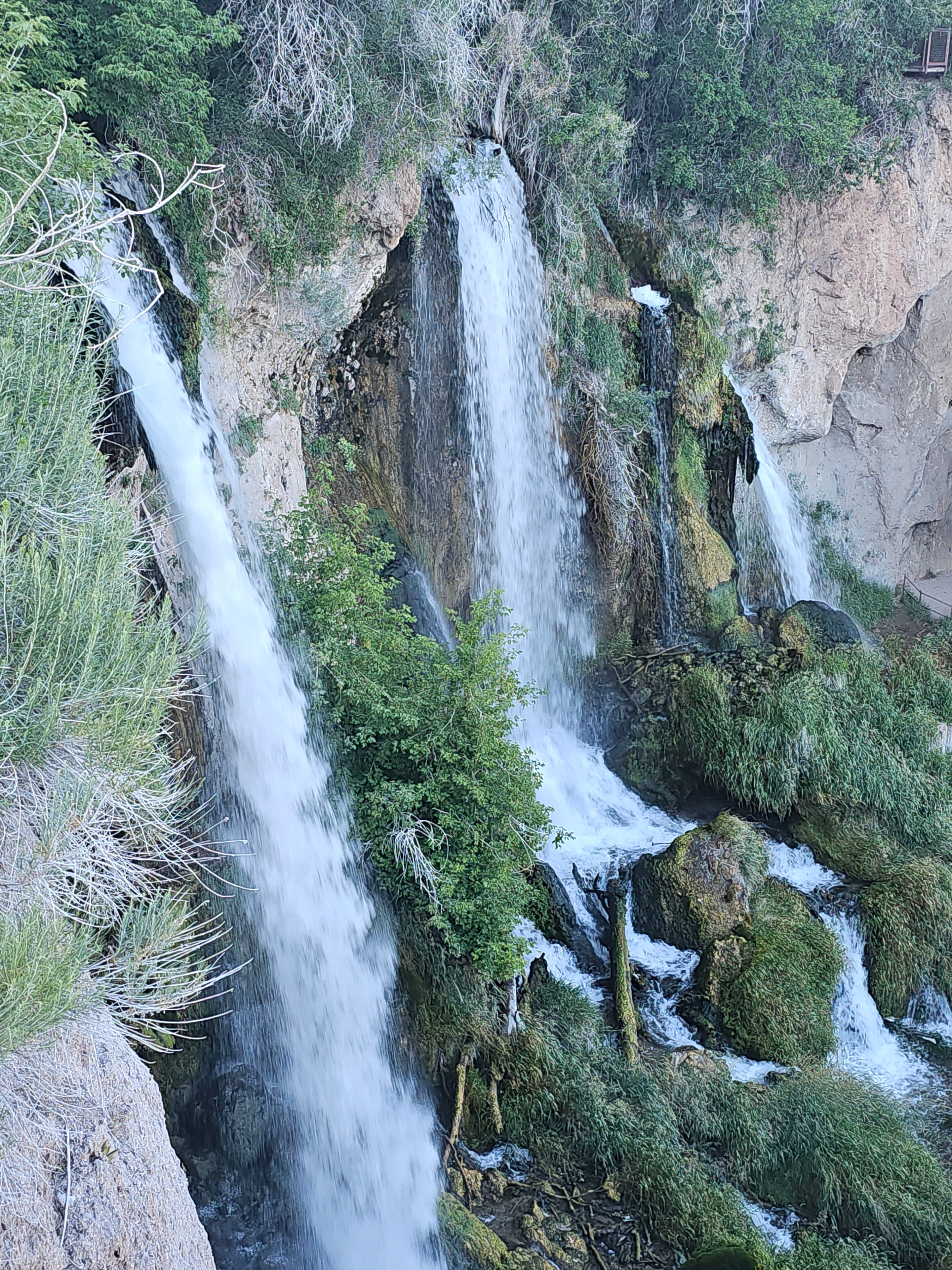
Rifle Falls State Park is one of Colorado's most unexpected and genuinely jaw-dropping stops — three separate waterfalls plunging 70 feet over a travertine cliff into a lush, moss-covered canyon that feels more like the Pacific Northwest than the high desert of western Colorado. You drive through Rifle Creek Canyon, the walls close in, the air gets cooler, and then you round a bend and there it is. Three waterfalls, side by side, roaring into a pool at the base of a cliff covered in green algae and dripping moss. It does not look real.

The caves are the part people don't expect. Behind and beside the falls, the travertine cliff is riddled with openings — some narrow passages, some wide enough to walk through, some that go back far enough to get genuinely dark. Zero and Reecee explored every one of them. Zero found a cave passage with a rag rug of moss on the floor and lay down in it like he had been waiting his whole life for exactly that spot. Reecee went straight for the creek and was soaked within about forty-five seconds of arriving, which is her standard operating procedure at any body of water.

The travertine formations are worth slowing down for. The cliff face is pocked and layered and dripping — pale cream and gold where it's dry, dark green and black where the water runs. There are horizontal cracks running the full width of the cliff with green algae growing out of them in thick tufts. The water sheets over the top and catches the light in a way that makes the whole face glow. Joe and Tina got a selfie standing in the mist with all three cascades behind them and it came out looking like a screensaver. It is not a screensaver. It is a real place you can drive to.

The creek below the falls is worth exploring too. Rocky streambed, driftwood, deep shadows under the overhang, and the sound of the water bouncing off the travertine walls. The aerial view from above the canopy shows all three cascades dropping through the tree cover — the kind of shot that makes people ask where it was taken. It was taken at Rifle Falls State Park, about 13 miles north of Rifle on State Highway 325, and it is absolutely worth the detour.

Rifle Falls State Park, Rifle, Colorado · 38 photos

Showing 4 of 38 photos

The Stanley Hotel, Estes Park, Colorado

Map

The Stanley Hotel in Estes Park is one of the most iconic and storied hotels in America — the grand dame that inspired Stephen King's The Shining and has been haunting guests and delighting history buffs since 1909. F.O. Stanley built it as a summer retreat for his wife Flora, whose tuberculosis improved dramatically in the Colorado mountain air. He opened the doors in 1909 and the place has been running ever since. Perched above the town with the Rocky Mountains filling the entire horizon behind it, the white Georgian Revival exterior is exactly as dramatic in person as it looks in every photograph you have ever seen of it.

The interior is the real thing. The lobby has an antique carriage, a grand piano, dark walnut woodwork, and oval mirrors that have been reflecting guests for over a century. The bar has an onyx bar top, a copper ceiling, and a whiskey collection that takes up an entire wall. We sat there long enough to work through a charcuterie board and two cocktails and still did not want to leave. The billiard room, the dining room with its mahogany chandelier, the Victorian parlors with their Persian rugs and Chesterfield sofas — every room is a period piece that actually functions as a hotel.

The haunted history is not a gimmick — the Stanley leans into it with full commitment and zero apology. Room 217 is the most requested room in the house, the one where Stephen King stayed in 1974 and had the nightmare that became The Shining. The bathroom has mint green dual sinks and a clawfoot tub and the kind of energy that makes you want to leave the lights on. The hedge maze sign out front is a direct nod to the film. There is a display case with an axe prop. The haunted room has magenta neon and a skeleton and a gold mirror and a floral ceiling that is genuinely unsettling. Joe and Tina took the tour of the Victorian-era rooms — the kitchen with its diamond tile and vintage stove, the bedroom with the carved four-poster bed and blue floral wallpaper, the bathroom with the penny tile and brass skylights — and came out with a lot of questions about what exactly was in that room with them.

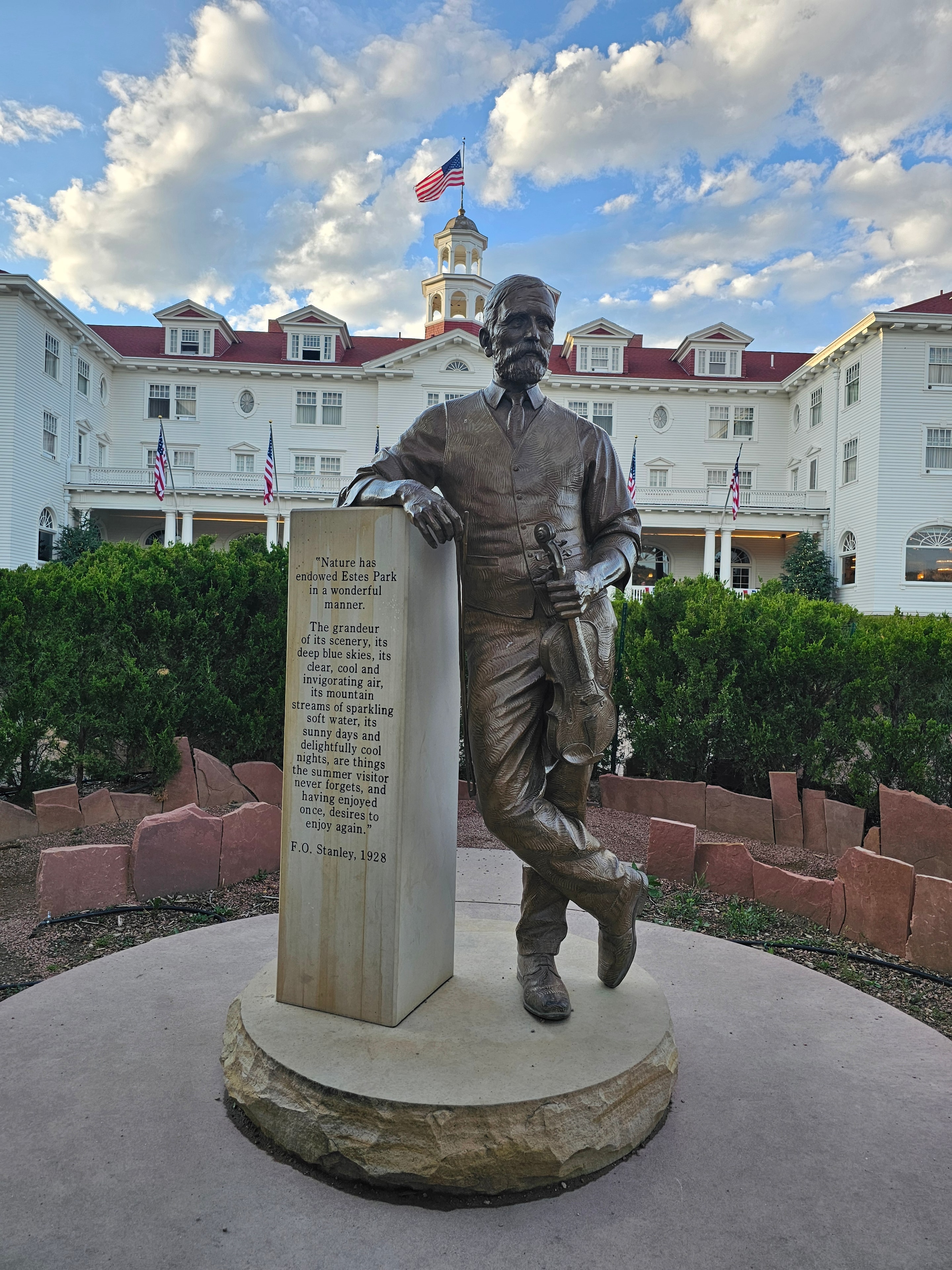
The grounds are worth the time. The bronze statue of F.O. Stanley stands on the lawn with a quote on the pedestal. There is a bronze Victorian woman with a rose near the garden. The rock waterfall sign. The caretaker's cottage. The view from the lawn of the Rockies behind the hotel is one of those views that makes you stop walking and just stand there. Estes Park is right below and Longs Peak is right above and the whole thing looks like a painting.

The Stanley Hotel is a bucket list stop. Go for the history, stay for the bar, and try not to think too hard about what is in the hallway at 3 AM.

The Stanley Hotel, Estes Park, Colorado · 50 photos

Showing 4 of 50 photos

Wolf Creek Pass, South Fork, Colorado

Map

Wolf Creek Pass is one of those roads that sorts people out. US-160 climbs to 10,857 feet through the San Juan Mountains between South Fork and Pagosa Springs, and it does not apologize for any of it. The grades are steep, the curves are tight, the switchbacks are real, and the drop-offs are right there. If you are towing a big rig, you either already know how to do this or you are about to learn. There is no middle ground on Wolf Creek Pass. The mountain will teach you.

The good news is that once you get up there, it is absolutely worth it. The views from the summit are the kind that make you forget you were white-knuckling the wheel ten minutes ago. Spruce and fir forest climbing the slopes in every direction, the San Juan peaks stacking up behind you, and the Treasure Falls trailhead waiting right there on the side of the road like it knew you were coming.

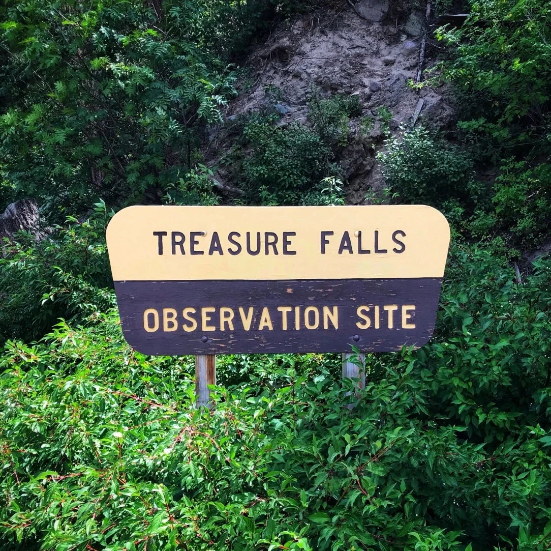
Treasure Falls is a 105-foot cascade that sheets down a broad cliff face into a mossy gorge, and the trail to get there is short, lush, and completely worth the stop. The spruce and fir close in around you, the air smells like pine and cold water, and the sound of the falls builds as you get closer until you come around a bend and there it is. All four of us did the full hike — Joe, Tina, Zero, and Reecee. Zero was extremely pleased with himself. Reecee was in the creek before we made it halfway. The boardwalk staircase at the top gives you a view straight down the canopy that is genuinely spectacular.

The pass itself is a full experience — not just a road to get through. The Brinkley handled it fine. The truck handled it fine. If you know your rig and you respect the grade, Wolf Creek Pass is one of the best drives in Colorado. If you are new to towing in the mountains, this is a good one to take slow, use your engine brake, and not be embarrassed about pulling over to let people pass. The mountain does not care about your schedule. It just cares whether you know what you are doing.

Wolf Creek Pass, South Fork, Colorado · 23 photos

Showing 4 of 23 photos

Rocky Mountain National Park, Estes Park, Colorado

Map

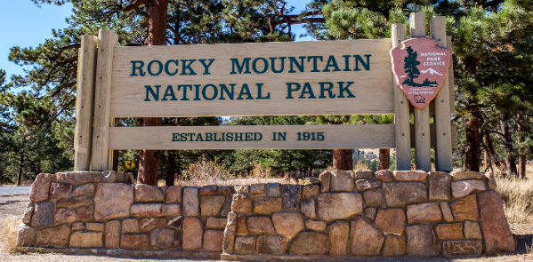
Rocky Mountain National Park, Estes Park, Colorado. We have been to a lot of national parks at this point. We have stood on canyon rims, walked through ancient cliff dwellings, hiked into slot canyons, and watched the sun set over the Great Sand Dunes. Rocky Mountain National Park is different. It is one of those places that earns a category of its own.

Trail Ridge Road is the spine of the whole experience. It climbs above treeline to over 12,000 feet and stays there for miles. The tundra up top is wide open and otherworldly — low-growing wildflowers, granite boulders, and views in every direction that go on forever. Longs Peak dominates the skyline. The Never Summer Range lines the horizon to the west. On a clear day you can see so far that the scale of the Rockies stops making sense in the best possible way. We kept pulling over. You can't not.

The wildlife encounters at Rocky Mountain are in a class by themselves. Moose wading through alpine lakes. Elk grazing in the meadows below the tundra. A bull elk that walked up to the truck on Trail Ridge Road, looked Joe in the eye through the window, and then licked the glass. That one is going to be hard to top. The park has so many animals moving so freely through it that every drive feels like a safari.

Alberta Falls is worth the hike every single time. The trail follows the creek through a gorgeous spruce and aspen corridor, and the falls themselves are powerful and loud in a way that fills the whole canyon. Bear Lake is one of the most photographed spots in the park and it earns every frame — the reflection of the peaks in the water on a calm morning is genuinely stunning. We also made it to the Continental Divide at Milner Pass, which is one of those moments that just feels significant. Standing on the exact line where water decides which ocean it's headed for is a thing.

Elk Meadow RV Resort in Estes Park is worth calling out specifically. The views from the campsite are remarkable — Rocky Mountain peaks visible from your awning, large pull-through spots, and a well-run operation that makes a great base camp for everything the park has to offer. If you're planning a Rocky Mountain National Park trip, this is the place to stay.

Rocky Mountain National Park, Estes Park, Colorado. LOVING LIFE HAVING FUN at one of the most spectacular national parks in the American West — and one that keeps pulling us back.

Rocky Mountain National Park, Estes Park, Colorado · 161 photos

Showing 4 of 161 photos